Lower Podluží
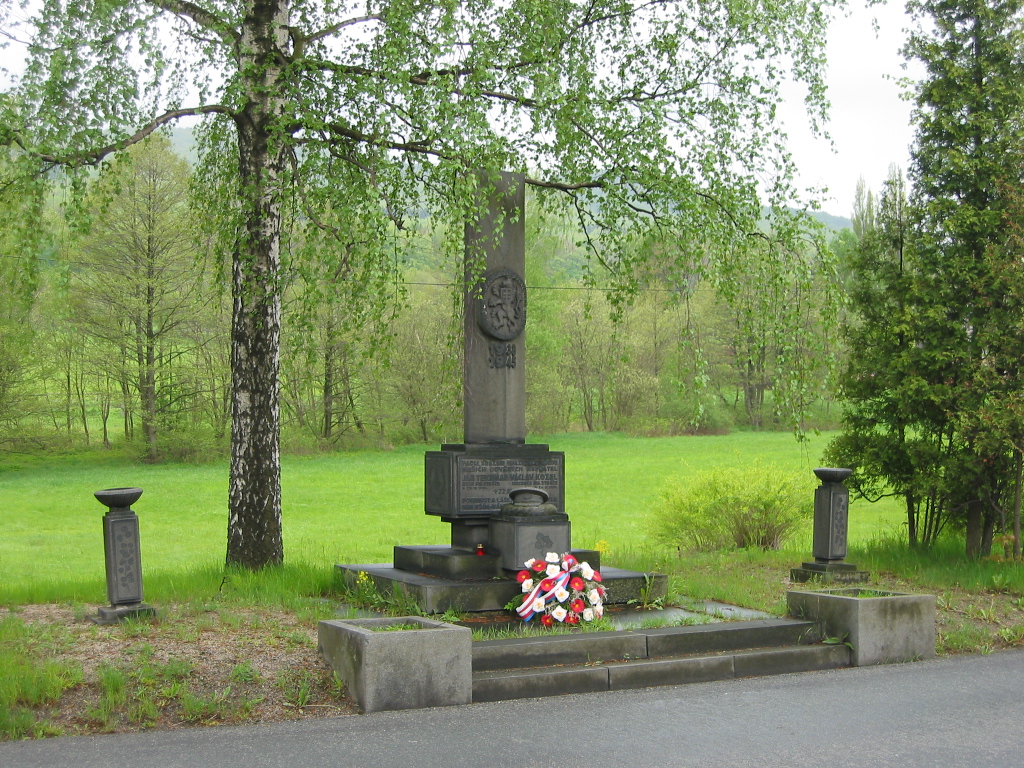
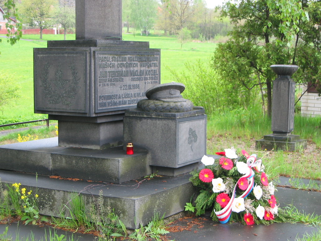
At the monument
Period: the Second World War - pre-war period
Location: 50°52'50.31 "N, 14°36'54.72 "E - show on map
Number of buried/memorialised: 2
EVH: CZE-4215-756
Address: crossroads by the Restaurant at the monument, behind the railway crossing
Owner of the grave: municipality Dolní Podluží
Description: memorial to the members of the financial guard who were shot in September 1938 by the Sudeten Germans.
List of those buried (commemorated at the memorial):
Václav Kozel, supervisor of the Financial Guard, born 24 October 1910, killed in action on 22 September 1938 in Dolní Podluží
Jan Teichman respicient of the financial guard, born 25 March 1896, killed in action on 22 September 1938, Dolní Podluží
Photo gallery:
Cemetery fountain
Period: World War I
Location: 50°52'21.06 "N, 14°34'59.94 "E - show on map
Number of buried/memorialised: n.a.
EVH: CZE-4215-39086
Address: in the middle of the municipal cemetery in Dolní Podluží, turning after the Na Mejtě crossroads
Owner of the grave: municipality Dolní Podluží
Description: it is a fountain in the shape of an artillery shell. The inscription on the top of the monument reads: Unseren toten im Weltkriege 1914 - 1918 Ehre und Dank der Heimat.
List of those buried (commemorated at the memorial):
Photo gallery:
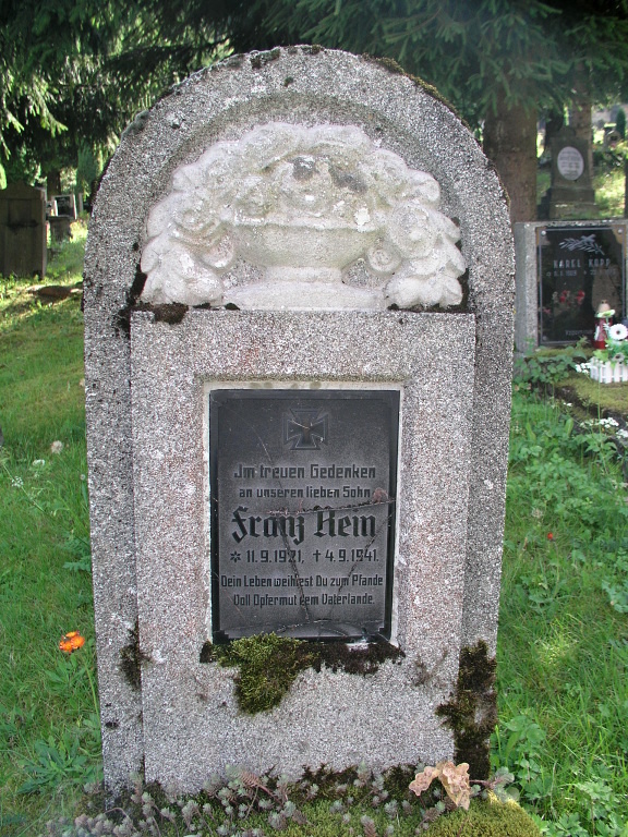
Kenotaf Franz Rein
Period: World War II
Location: 50°52'21.72 "N, 14°34'59.34 "E - show on map
Number of buried/remembered: 1
EVH: CZE-4215-39087
Address: at the bottom of the municipal cemetery in Dolní Podluží, turning after the Na Mejtě crossroads
Owner of the grave: municipality Dolní Podluží
Description: detached memorial - cenotaph with the text: Im treuen Gedenken an unseren lieben Sohn. Dein Leben weihtest Du zum Pfande Voll Opfermut dem Vaterlande.
List of those buried (commemorated at the memorial).
Photo gallery:
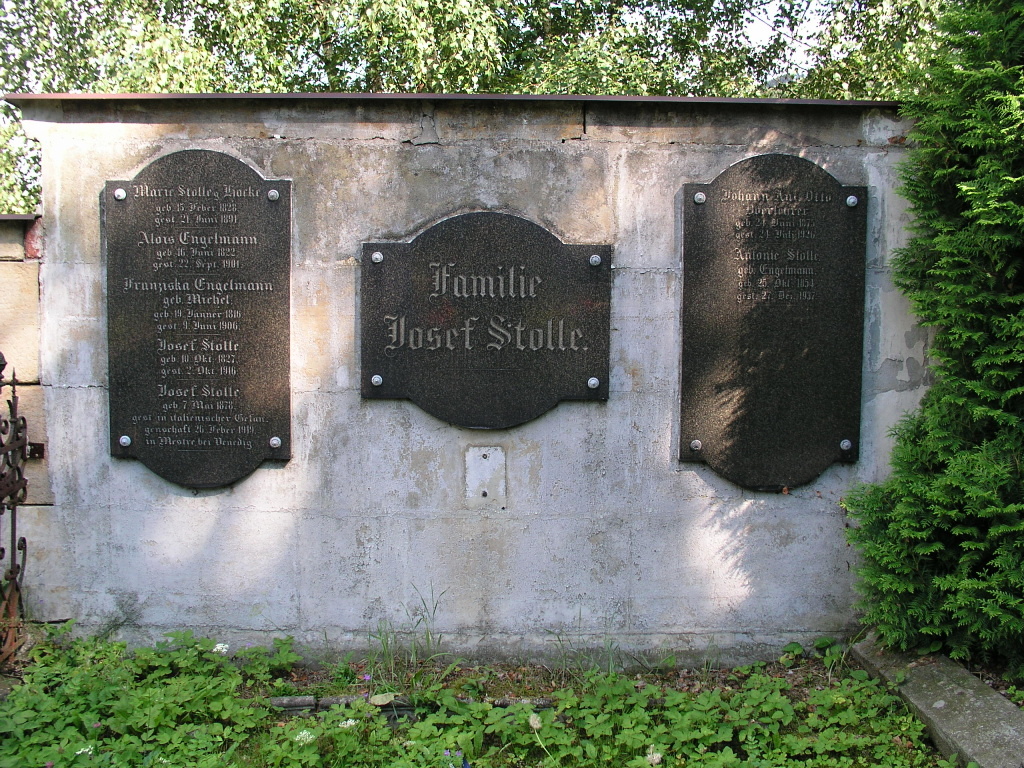
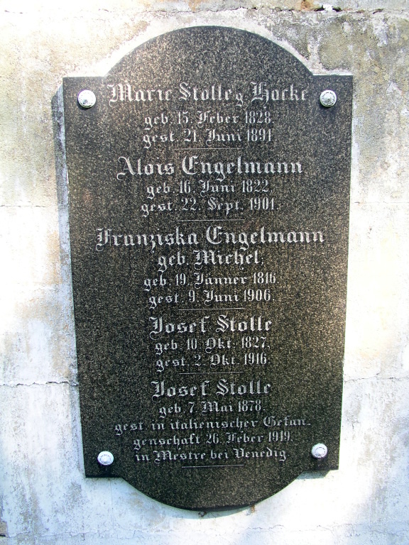
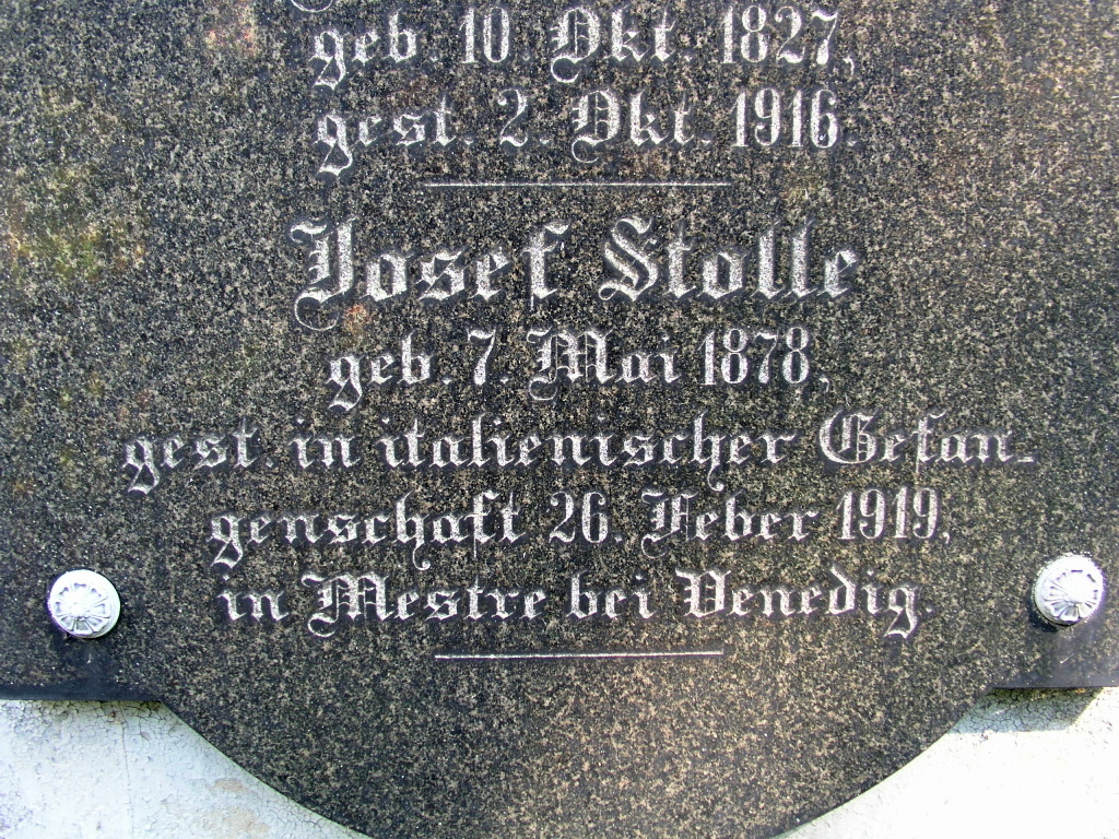
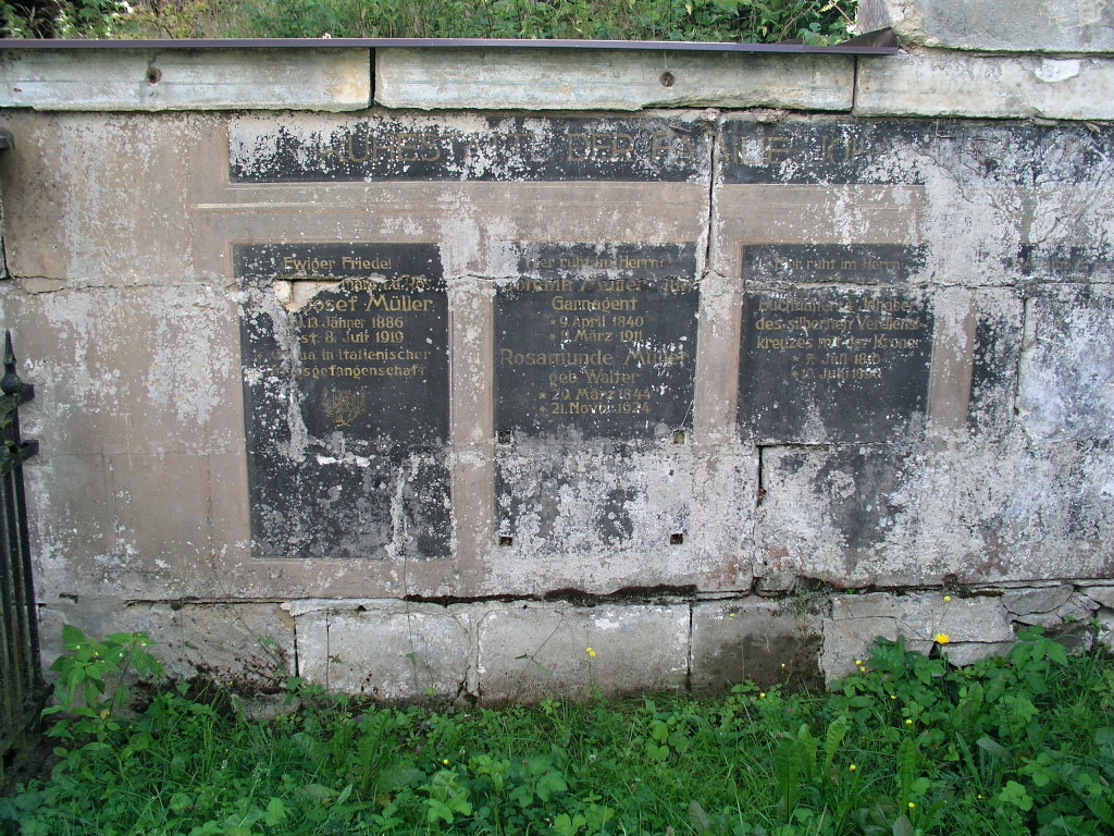
Kenotaf Josef Stolle
Period: first world war
Location: 50°52'21,72 "N, 14°34'59,34 "E - show on map
Number of buried/remembered: 1
EVH: CZE-4215-39088
Address: on the left side of the municipal cemetery in Dolní Podluží, turning after the Na Mejtě crossroads
Owner of the grave: municipality Dolní Podluží
Description: the right one of the three black stone slabs on the inner side of the cemetery wall.
List of those buried (commemorated on the memorial site).
Photo gallery:
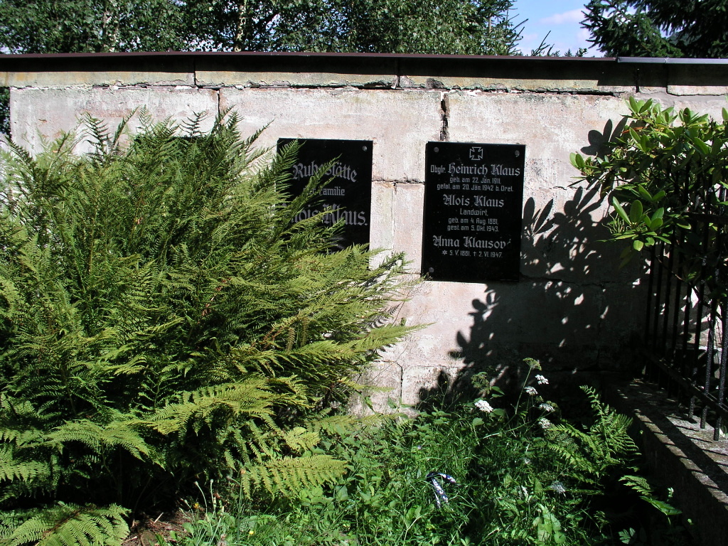
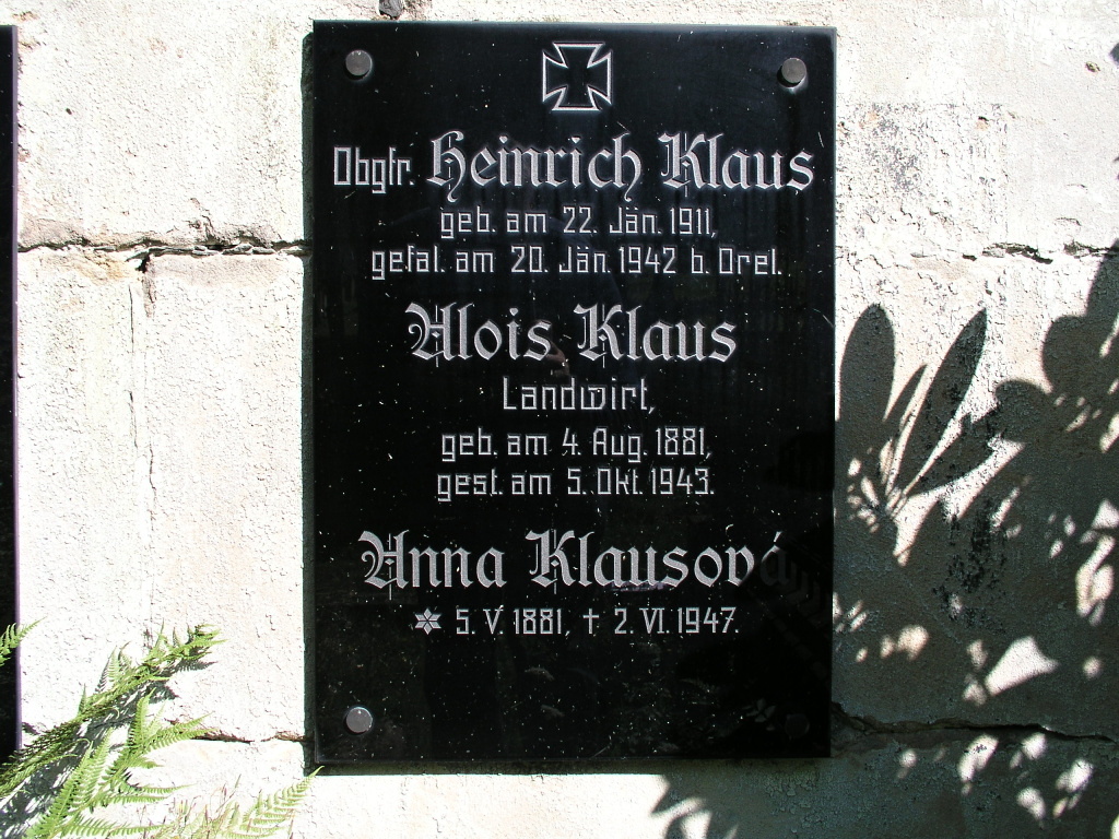
Kenotaf Heinrich Klaus
Period: World War II
Location: 50°52'20.58 "N, 14°34'59.82 "E - show on map
Number of buried/remembered: 1
EVH: CZE-4215-39083
Address: in the left part of the municipal cemetery in Dolní Podluží, turning after the crossroads Na Mejtě
Owner of the grave: municipality Dolní Podluží
Description: the right one of the three black stone slabs on the inner side of the cemetery wall.
List of those buried (commemorated on the memorial site): Obgrf. Heinrich Klaus
Photo gallery:
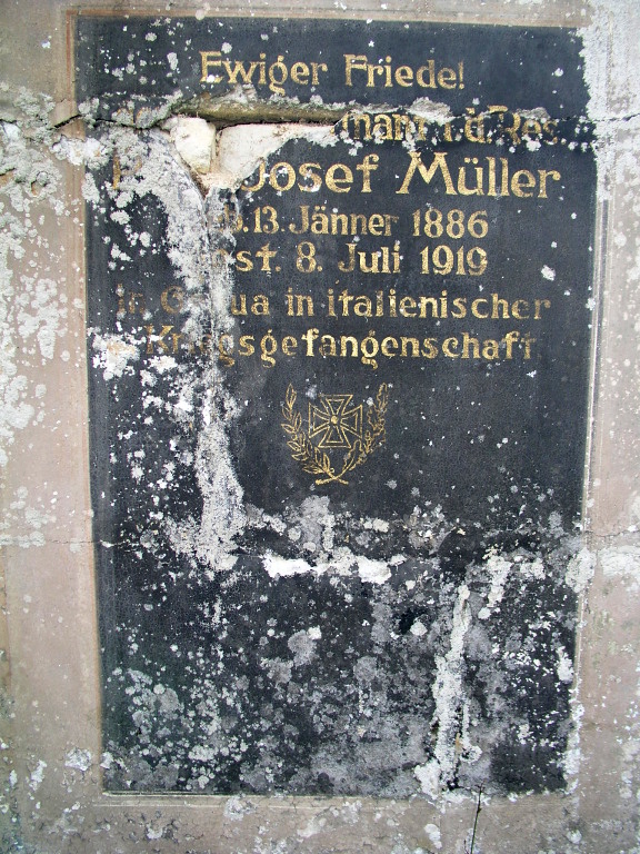
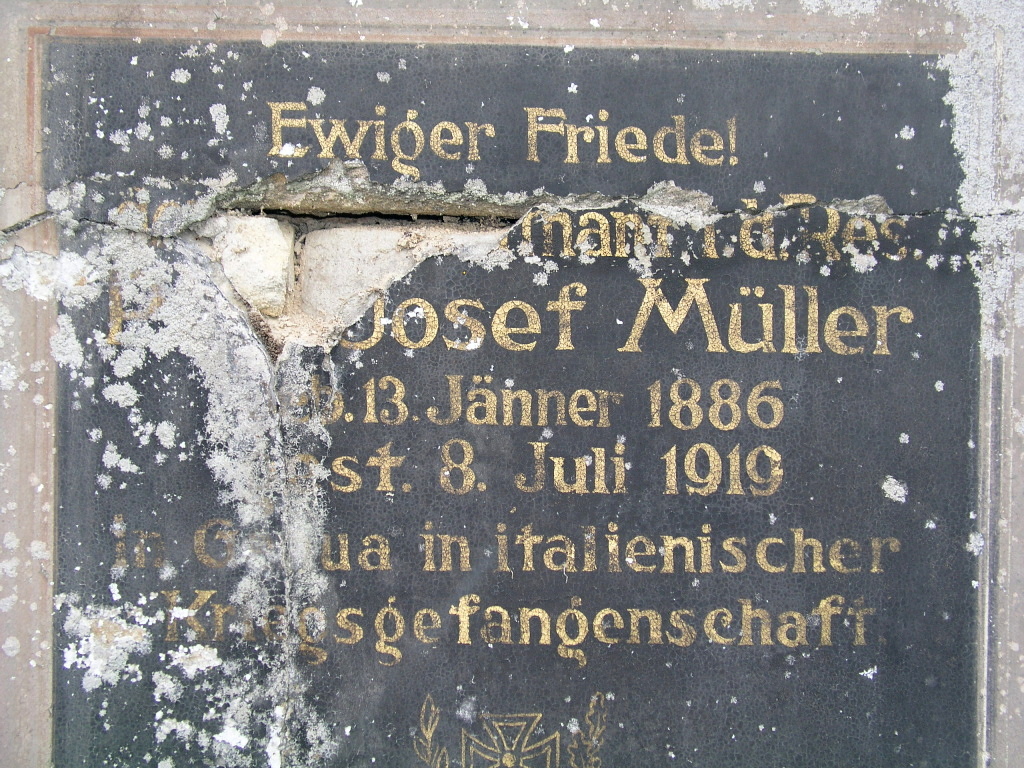
Kenotaf Josef Müller
Period: first world war
Location: 50°52'20.10 "N,14°34'58.74 "E - show on map
Number of buried/remembered: 1
EVH: CZE-4215-39084
Address: in the upper part of the municipal cemetery in Dolní Podluží, the turn off after the crossroads Na Mejtě
Owner of the grave: municipality Dolní Podluží
Description: left painted fresco on the common tombstone on the inner side of the cemetery wall.
List of the buried (commemorated on the memorial site): Oberleutnant Josef Müller
Photo gallery:
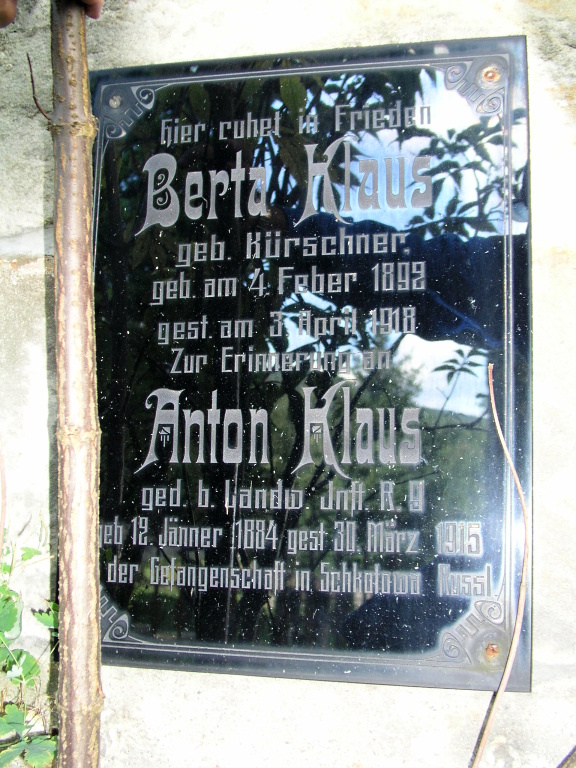
Kenotaf Anton Klaus
Period: World War I
Location: 50°52'20.76 "N, 14°34'57.12 "E - show on map
Number of buried/remembered: 1
EVH: CZE-4215-39085
Address: in the upper right part of the municipal cemetery in Dolní Podluží, turning after the crossroads Na Mejtě
Owner of the grave: municipality Dolní Podluží
Description: glass plaque on the inside of the cemetery wall.
List of those buried (commemorated on the memorial): Anton Klaus
Photo gallery: